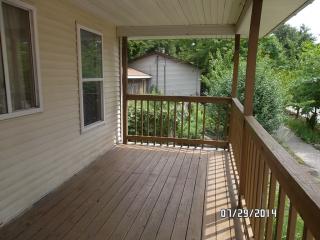
Purchase History
| Date | Event | Price | Source | Agents |
|---|---|---|---|---|
| 06/17/2014 | Sold | $9,000 | Public records | |
| 02/25/2011 | Sold | $66,441 | Public records |
Cost estimate history
| Year | Tax | Assessment | Market |
|---|---|---|---|
| 2013 | N/A | $18,200 | $36,400 |
Advertisement
Continue Reading Below
Market Activities
9th St Fire Incident History
To date, we have no information about fire incidents in 2025
29 Jun 2019
Building fires
Property Use —
1 or 2 family dwelling
Area of Origin —
Cooking area, kitchen
Heat Source —
Arcing
17 Jan 2019
Building fires
Property Use —
1 or 2 family dwelling
Area of Origin —
Substructure area or space, crawl space
10 Jan 2019
Cooking fire, confined to container
Property Use —
1 or 2 family dwelling
Area of Origin —
Cooking area, kitchen
08 Aug 2016
Natural vegetation fire, other
Property Use —
1 or 2 family dwelling
Area of Origin —
Open area - outside; included are farmland, field
9 St Incidents registered in FEMA
(Federal Emergency Management Agency)
To date, we have no information about incidents registered in FEMA in 2025
24 Jun 2015
Gas leak (natural gas or LPG)
Property Use —
1 or 2 family dwelling
14 Mar 2015
Power line down
Property Use —
1 or 2 family dwelling
25 Dec 2014
Unauthorized burning
Property Use —
1 or 2 family dwelling
14 May 2014
Fuel burner/boiler malfunction, fire confined
Property Use —
1 or 2 family dwelling
Properties Nearby
| Street Address |
|---|
1511 9 St, Port Huron, MI 48060-5809 Single Family Residential
|
1512 9 St, Port Huron, MI 48060-5810
|
1513 9 St, Port Huron, MI 48060-5809 Unspecified
|
1514 9 St, Port Huron, MI 48060-5810 Unspecified
|
1515 9 St, Port Huron, MI 48060-5809 Single Family Residential
|
1630 9 St, Port Huron, MI 48060-5843 Single Family Residential
|
1809 9 St, Port Huron, MI 48060-6332 Single Family Residential
|
1813 9 St, Port Huron, MI 48060-6332 Single Family Residential |
1815 9 St, Port Huron, MI 48060-6332 Unspecified
|
1819 9 St, Port Huron, MI 48060-6332 Single Family Residential
|

