Purchase History
| Date | Event | Price | Source | Agents |
|---|---|---|---|---|
| 05/06/2008 | Sold | $1 | Public records | |
| 10/30/2006 | Sold | $190,550 | Public records | |
| 09/12/2000 | Sold | $95,000 | Public records | |
| 06/22/1998 | Sold | $35,000 | Public records |
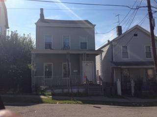
PURCHASE HISTORY 72 10th St, Paterson NJ
Cost estimate history
| Year | Tax | Assessment | Market |
|---|---|---|---|
| 2014 | N/A | $240,500 | N/A |
| 2013 | $6,599 | N/A | N/A |
Advertisement
Continue Reading Below
Market Activities
10th St Fire Incident History
To date, we have no information about fire incidents in 2025
18 Feb 2016
Outside equipment fire
Property Use —
Residential street, road or residential driveway
Area of Origin —
Outside area, other
First Ignition —
Flammable liquid/gas in container or pipe
Heat Source —
Arcing
23 Oct 2010
Passenger vehicle fire
Property Use —
Residential street, road or residential driveway
Area of Origin —
Engine area, running gear, wheel area
29 Jul 2010
Building fires
Property Use —
1 or 2 family dwelling
Area of Origin —
Ceiling & floor assembly, crawl space b/t stories
First Ignition —
Structural member or framing
Heat Source —
Arcing
10 Jul 2009
Building fires
Property Use —
1 or 2 family dwelling
First Ignition —
Exterior wall covering or finish
Heat Source —
Radiated heat from another fire
10th St Incidents registered in FEMA
(Federal Emergency Management Agency)
To date, we have no information about incidents registered in FEMA in 2025
01 Dec 2015
Cooking fire, confined to container
Property Use —
1 or 2 family dwelling
02 Sep 2015
Oil or other combustible liquid spill
Property Use —
Residential street, road or residential driveway
02 Jun 2015
Gas leak (natural gas or LPG)
Property Use —
Warehouse
11 Mar 2015
Gas leak (natural gas or LPG)
Property Use —
Warehouse
Properties Nearby
| Street Address |
|---|
9 10th St, Paterson, NJ 07506-3808 Single Family
|
55 10th St, Paterson, NJ 07506-3808 Single Family Residential
|
65 10th St, Paterson, NJ 07506-3808 Single Family Residential
|
69 10th St, Paterson, NJ 07506-3839 Single Family Residential
|
70 10th St, Paterson, NJ 07506-3838 Single Family Residential
|
93 10th St, Paterson, NJ 07506-3839 Single Family Residential
|
95 10th St, Paterson, NJ 07506-3839 Single Family Residential
|
97 10th St, Paterson, NJ 07506-3839 Single Family
|