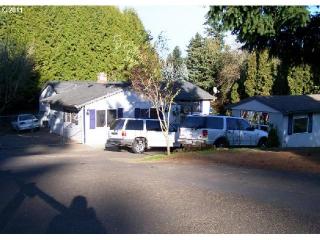
Purchase History
| Date | Event | Price | Source | Agents |
|---|---|---|---|---|
| 11/28/2007 | Sold | $226,800 | Public records | |
| 10/16/2006 | Sold | $145,000 | Public records |
Cost estimate history
| Year | Tax | Assessment | Market |
|---|---|---|---|
| 2014 | $2,820 | $147,100 | $176,560 |
Local Brokers

Agent: Jesus Gomez
Phone: 503-653-0607
Company: RE/MAX EQUITY GROUP-SUNNYSIDE OFFICE
Company Phone: 503-653-0607
Advertisement
Continue Reading Below
Market Activities
Burnside St Fire Incident History
To date, we have no information about fire incidents in 2025
30 Nov 2019
Building fires
Property Use —
1 or 2 family dwelling
Area of Origin —
Courtyard, patio, porch, terrace
24 Aug 2019
Outside rubbish, trash or waste fire
Property Use —
Residential street, road or residential driveway
Area of Origin —
Highway, parking lot, street: on or near
First Ignition —
Wearing apparel not on a person
Heat Source —
Cigarette lighter
22 Aug 2019
Building fires
Property Use —
Church, mosque, synagogue, temple, chapel
Area of Origin —
Wall surface: exterior
First Ignition —
Structural component or finish, other
Heat Source —
Cigarette
17 Aug 2019
Outside mailbox fire
Property Use —
Outside or special property, other
Area of Origin —
Highway, parking lot, street: on or near
First Ignition —
Item First Ignited, Other
Burnside St Incidents registered in FEMA
(Federal Emergency Management Agency)
To date, we have no information about incidents registered in FEMA in 2025
08 Oct 2015
Building fires
25 Sep 2015
Cooking fire, confined to container
05 Jul 2015
Unauthorized burning
Property Use —
1 or 2 family dwelling
04 Jul 2014
Building fires
Burnside St Crime Incidents History
To date, we have no information about crime incidents in 2025
08 Aug 2017
Traffic
18800 Block Burnside St, Portland OR
Case Number —
PG17000044949
Description —
TRIMET INCIDENT - COLD
07 Aug 2017
Missing Person
18000 Block Burnside St, Portland OR
Case Number —
PG17000044755
Description —
MISSING - PERSON LOST,FOUND,RUNNER
07 Aug 2017
Other
18700 Block Burnside St, Portland OR
Case Number —
PG17000044744
Description —
911 HANGUP
07 Aug 2017
Disorder
17800 Block BLOCK Burnside St, Portland OR
Case Number —
PG17000044734
Description —
DISTURBANCE - PRIORITY
Properties Nearby
| Street Address |
|---|