Cost estimate history
| Year | Tax | Assessment | Market |
|---|---|---|---|
| 2011 | $646 | N/A | N/A |
| 2010 | N/A | $13,416 | $26,832 |
Advertisement
Continue Reading Below
Market Activities
To date, we have no information about market activities in 2026
Apr 2023
Sold
Apr 2016
Recent Rent
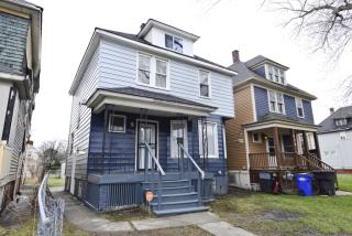
580 Euclid St
Price history :
- 2100 sqft
- 4 beds
- 1.5 baths
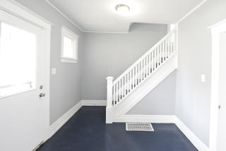
Another one by MCR, This home has just undergone a major face lift, from the inside-out. This...
Euclid St Fire Incident History
To date, we have no information about fire incidents in 2026
16 Feb 2019
Building fires
Property Use —
1 or 2 family dwelling
Area of Origin —
Bedroom - < 5 persons; included are jail or prison
06 Feb 2019
Passenger vehicle fire
Property Use —
Residential street, road or residential driveway
Area of Origin —
Engine area, running gear, wheel area
28 Nov 2018
Passenger vehicle fire
Property Use —
Residential street, road or residential driveway
Area of Origin —
Operator/passenger area of transportation equip.
01 Jul 2018
Building fires
Property Use —
1 or 2 family dwelling
Area of Origin —
Roof surface: exterior
Euclid St Incidents registered in FEMA
(Federal Emergency Management Agency)
To date, we have no information about incidents registered in FEMA in 2026
21 Nov 2012
Toxic condition, other
Property Use —
Street, other
04 Aug 2012
Cooking fire, confined to container
Property Use —
1 or 2 family dwelling
14 Apr 2012
Cooking fire, confined to container
Property Use —
1 or 2 family dwelling
Properties Nearby
| Street Address |
|---|
419 Euclid St, Detroit, MI 48202-2212 Unspecified
|
445 Euclid St, Detroit, MI 48202-2212 Single Family Residential
|
710 Euclid St, Detroit, MI 48202-2029 Unspecified
|
1135 Euclid St, Detroit, MI 48202-1921 Single Family Residential
|
1167 Euclid St, Detroit, MI 48202-1921 Single Family Residential
|
1190 Euclid St, Detroit, MI 48202-1922 Lot/Land
|
1223 Euclid St, Detroit, MI 48202-1946 Single Family Residential
|
1462 Euclid St, Detroit, MI 48206-2413 Single Family Residential
|