Cost estimate history
| Year | Assessment | ||
|---|---|---|---|
| 2016 | $848,100 | ||
| 2015 | $792,600 | ||
| 2014 | $756,300 | ||
| 2013 | $756,300 | ||
| 2012 | $756,300 | ||
| 2011 | $755,800 | ||
| 2010 | $829,800 | ||
| 2009 | $846,700 | ||
| 2008 | $846,700 | ||
| 2007 | $863,200 | ||
| 2006 | $838,100 | ||
| 2005 | $798,200 | ||
| 2004 | $748,600 | ||
| 2003 | $668,400 | ||
| 2002 | $668,400 | ||
| 2001 | $559,700 | ||
| 2000 | $511,100 | ||
| 1999 | $465,100 | ||
| 1998 | $420,100 | ||
| 1997 | $385,400 | ||
| 1996 | $367,000 | ||
| 1995 | $331,200 | ||
| 1994 | $315,400 | ||
| 1993 | $313,100 | ||
| 1992 | $324,600 |
Advertisement
Continue Reading Below
Kirkstall Rd Fire Incident History
To date, we have no information about fire incidents in 2025
06 Apr 2003
Building fires
Property Use —
1 or 2 family dwelling
Area of Origin —
Heating room or area, water heater area
First Ignition —
Atomized liquid, vaporized liquid, aerosol.
Heat Source —
Spark, ember or flame from operating equipment
Properties Nearby
| Street Address |
|---|
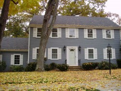
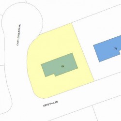
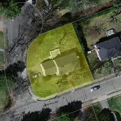
8 Kirkstall Rd, Newton, MA 02460-2218 Single Family
|
37 Kirkstall Rd, Newton, MA 02460-2244 Single Family
|
40 Kirkstall Rd, Newton, MA 02460-2218 Single Family
|
47 Kirkstall Rd, Newton, MA 02460-2244 Single Family
|
54 Kirkstall Rd, Newton, MA 02460-2218 Single Family
|