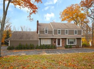

Purchase History
| Date | Event | Price | Source | Agents |
|---|---|---|---|---|
| 06/27/2005 | Sold | $850,000 | Public records | George Walsh |
| 09/26/1995 | Sold | $390,000 | Public records |
Cost estimate history
| Year | Tax | Assessment | Market |
|---|---|---|---|
| 2014 | N/A | $641,800 | N/A |
| 2013 | $14,716 | N/A | N/A |
Advertisement
Continue Reading Below
Market Activities
Shrewsbury Dr Fire Incident History
To date, we have no information about fire incidents in 2025
21 Oct 2011
Building fires
Property Use —
1 or 2 family dwelling
Area of Origin —
Wall surface: exterior
First Ignition —
Item First Ignited, Other
Heat Source —
Radiated, conducted heat from operating equipment
13 Jul 2010
Building fires
Property Use —
1 or 2 family dwelling
Area of Origin —
Vehicle storage area; garage, carport
First Ignition —
Magazine, newspaper, writing paper
Heat Source —
Chemical reaction
26 May 2010
Passenger vehicle fire
Property Use —
Residential street, road or residential driveway
Area of Origin —
Engine area, running gear, wheel area
First Ignition —
Flammable liquid/gas - in/from engine or burner
Heat Source —
Radiated, conducted heat from operating equipment
Shrewsbury Dr Incidents registered in FEMA
(Federal Emergency Management Agency)
To date, we have no information about incidents registered in FEMA in 2025
13 Nov 2015
Gasoline or other flammable liquid spill
Property Use —
Residential street, road or residential driveway
02 Jul 2014
Power line down
Property Use —
Residential street, road or residential driveway
11 Dec 2013
Gas leak (natural gas or LPG)
Property Use —
1 or 2 family dwelling
12 Sep 2011
Overheated motor
Property Use —
Residential board and care
Properties Nearby
| Street Address |
|---|
29 Shrewsbury Dr, Livingston, NJ 07039-1511 Single Family
|
35 Shrewsbury Dr, Livingston, NJ 07039-1511 Single Family Residential
|
38 Shrewsbury Dr, Livingston, NJ 07039-1512 Single Family
|
44 Shrewsbury Dr, Livingston, NJ 07039-1512 Single Family Residential
|
45 Shrewsbury Dr, Livingston, NJ 07039-1511 Single Family
|
46 Shrewsbury Dr, Livingston, NJ 07039-1512 Single Family Residential
|
57 Shrewsbury Dr, Livingston, NJ 07039-3401 Single Family Residential
|
82 Shrewsbury Dr, Livingston, NJ 07039-3403 Single Family Residential
|
85 Shrewsbury Dr, Livingston, NJ 07039-3405 Single Family Residential
|
88 Shrewsbury Dr, Livingston, NJ 07039-3403 Single Family Residential
|