81 Rowland St Springfield, MA 01107 / 1008

Residence for Single Family

(UPDATED: 08/06/2025)
  • 3 Beds
  • 1 Baths
  • 9.000 square feet
Sold Feb 2022
$215,000
Property Report

Information about property on 81 Rowland St, Springfield MA, 01107-1008. Find out owner contacts, building history, price, neighborhood at Homemetry Address Directory.

Property Details

The property has an aluminum and vinyl facade and attached garage on 0,21 acres lot.

Facts

  • Built in 1956
  • Lot size 9,000 sqft
  • Building 1
  • Rooms 5
  • Bedrooms 3
  • Stories 1 story with basement
  • Style Ranch/Rambler
  • Basement Full Basement
  • Heating & Cooling
  • Heat type Hot Water
  • Exterior Home Features
  • Exterior material Metal
  • Exterior walls Siding (Alum/Vinyl)
  • Parking & Garage
  • Parking Attached Garage
Advertisement
Continue Reading Below

Listing info

  • Last sold Mar 1982 for $26,000

Householders and Tenants for 81 Rowland St, Springfield MA

Cost estimate history

YearTaxAssessmentMarket
2014 $1,636 $83,000 N/A
Advertisement
Continue Reading Below

Where is 81 Rowland St, Springfield MA located on map?

Market Activities

To date, we have no information about market activities in 2025
Feb 2022 Sold
81 Rowland St
Price history :
  • Single Family
  • 1,600 sqft
  • 3 beds
  • 1 bath
Aug 2021 Sold
81 Rowland St
Price history :
  • Single Family
  • 1,600 sqft
  • 3 beds
  • 1 bath

View more

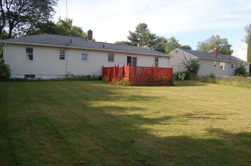
Rowland St Fire Incident History

To date, we have no information about fire incidents in 2025
07 Jun 2018 Building fires
Property Use —
Manufacturing, processing
Area of Origin —
Ceiling & floor assembly, crawl space b/t stories
First Ignition —
Structural member or framing
05 May 2003 Brush, or brush and grass mixture fire
Property Use —
1 or 2 family dwelling
Area of Origin —
Outside area, other
First Ignition —
Light vegetation - not crop, including grass
Heat Source —
Match
15 Apr 2002 Passenger vehicle fire
Property Use —
Open land or field
Area of Origin —
Fuel tank, fuel line
First Ignition —
Flammable liquid/gas in container or pipe

Rowland St Incidents registered in FEMA
(Federal Emergency Management Agency)

To date, we have no information about incidents registered in FEMA in 2025
23 Jan 2015 Cooking fire, confined to container
Property Use —
1 or 2 family dwelling
22 Oct 2013 Cooking fire, confined to container
Property Use —
1 or 2 family dwelling
12 Aug 2013 Cooking fire, confined to container
Property Use —
1 or 2 family dwelling
10 Mar 2013 Carbon monoxide incident
Property Use —
1 or 2 family dwelling

View more

Properties Nearby

Street Address
64 Rowland St, Springfield, MA 01107-1009
Single Family
  • 3 beds
  • 1.5 baths
  • 962 sqft
  • Built in 1956
67 Rowland St, Springfield, MA 01107-1008
Single Family
  • 3 beds
  • 1 bath
  • Lot: 9,000 sqft
  • Built in 1956
70 Rowland St, Springfield, MA 01107-1009
Single Family
  • 2 beds
  • 1 bath
  • Lot: 7,806 sqft
  • Built in 1956
75 Rowland St, Springfield, MA 01107-1008
Single Family
  • 3 beds
  • 2 baths
  • Lot: 9,000 sqft
  • Built in 1956
78 Rowland St, Springfield, MA 01107-1009
Single Family
  • 3 beds
  • 1.5 baths
  • 962 sqft
  • Built in 1950
89 Rowland St, Springfield, MA 01107-1008
Single Family
  • 3 beds
  • 1 bath
  • Lot: 9,000 sqft
  • Built in 1956
 

FAQ about the house at 81 Rowland St, Springfield, MA

Advertisement

NOTICE: You may not use Homemetry or the information it provides to make decisions about employment, credit, housing or any other purpose that would require Fair Credit Reporting Act (FCRA) compliance. Homemetry is not a Consumer Reporting Agency (CRA) as defined by the FCRA and does not provide consumer reports.