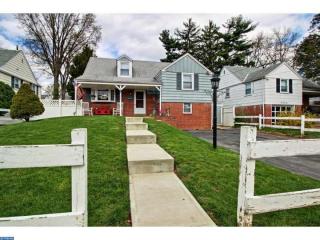
Purchase History
| Date | Event | Price | Source | Agents |
|---|---|---|---|---|
| 10/31/2001 | Sold | $129,900 | Public records | |
| 10/26/1995 | Sold | $92,000 | Public records |
Cost estimate history
| Year | Tax | Assessment | Market |
|---|---|---|---|
| 2014 | $2,676 | N/A | N/A |
| 2012 | N/A | $24,896 | N/A |
| 2007 | N/A | N/A | $77,800 |
Advertisement
Continue Reading Below
Market Activities
Lansing St Fire Incident History
To date, we have no information about fire incidents in 2025
15 Nov 2019
Cooking fire, confined to container
Property Use —
Residential, other
25 May 2019
Outside rubbish fire, other
Property Use —
Outside or special property, other
Area of Origin —
Outside area, other
First Ignition —
Flammable liquid/gas - uncontained
Heat Source —
Heat from other open flame or smoking materials
05 Dec 2017
Outside rubbish, trash or waste fire
Property Use —
Residential street, road or residential driveway
Area of Origin —
Courtyard, patio, porch, terrace
First Ignition —
Rubbish, trash, or waste
20 Nov 2017
Cooking fire, confined to container
Property Use —
1 or 2 family dwelling
Area of Origin —
Cooking area, kitchen
First Ignition —
Organic materials, other
Heat Source —
Spark, ember or flame from operating equipment
Lansing St Incidents registered in FEMA
(Federal Emergency Management Agency)
To date, we have no information about incidents registered in FEMA in 2025
08 Nov 2015
Building or structure weakened or collapsed
Property Use —
Residential street, road or residential driveway
27 Jul 2015
Electrical wiring/equipment problem, other
Property Use —
Residential street, road or residential driveway
08 Mar 2015
Carbon monoxide incident
Property Use —
Boarding/rooming house, residential hotels
07 Feb 2015
Authorized controlled burning
Property Use —
1 or 2 family dwelling
Properties Nearby
| Street Address |
|---|
920 Lansing St, Philadelphia, PA 19111-3215 Single Family Residential
|
1022 Lansing St, Philadelphia, PA 19111-3217 Single Family
|
1701 Lansing St, Philadelphia, PA 19111-3501 Single Family
|
1736 Lansing St, Philadelphia, PA 19111-3502 Single Family
|
1827 Lansing St, Philadelphia, PA 19111-3503 Single Family
|
1831 Lansing St, Philadelphia, PA 19111-3503 Single Family Residential
|