10 Griswold Ave Cranston, RI 02910 / 4209

Residence for Single Family

(UPDATED: 08/03/2025)
  • 3 Beds
  • 1 Baths
  • 4.500 square feet
Sold Feb 2022
$260,000
Property Report

Information about property on 10 Griswold Ave, Cranston RI, 02910-4209. Find out owner contacts, building history, price, neighborhood at Homemetry Address Directory.

Property Details

At 10 Griswold Avenue, Cranston, RI stands a single-family one ranch.

Facts

  • Built in 1950
  • Lot size 4,500 sqft
  • Rooms 5
  • Bedrooms 3
  • Stories 1 story
  • Style Ranch/Rambler
  • Heating & Cooling
  • Heat type Hot Water
  • Exterior Home Features
  • Exterior material Other
  • Exterior walls Asbestos shingle
  • Roof type Asphalt
Advertisement
Continue Reading Below

Misc

  • Units 1

Listing info

  • Last sold Dec 2000 for $125,000

Features

  • A/C

Householders and Tenants for 10 Griswold Ave, Cranston RI

Purchase History

DateEventPriceSourceAgents
12/01/2000 Sold $125,000 Public records
10/30/1998 Sold $100,000 Public records
07/01/1998 Sold $81,000 Public records

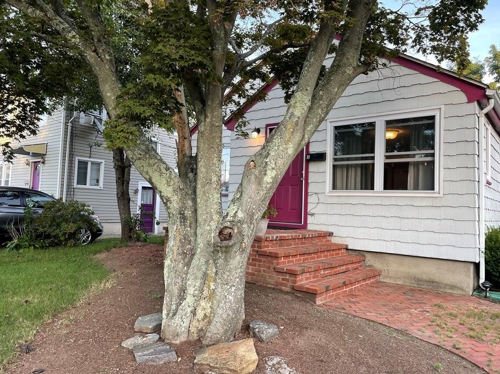
PURCHASE HISTORY 10 Griswold Ave, Cranston RI

07/01/199812/01/2000Date$0$10k$20k$30k$40k$50k$60k$70k$80k$90k$100k$110k$120k$130kPrices

Cost estimate history

YearTaxAssessmentMarket
2014 $3,191 $139,700 N/A
Advertisement
Continue Reading Below

Where is 10 Griswold Ave, Cranston RI located on map?

Market Activities

To date, we have no information about market activities in 2025
Feb 2022 Sold
10 Griswold Ave
Price history :
  • Single Family
  • 1,588 sqft
  • 2 beds
  • 1 bath
Sep 2021 Sold
10 Griswold Ave
Price history :
  • Single Family
  • 1,588 sqft
  • 2 beds
  • 1 bath

View more

Griswold Ave Fire Incident History

To date, we have no information about fire incidents in 2025
09 Aug 2017 Special outside fire, other
Property Use —
1 or 2 family dwelling
Area of Origin —
Outside area, other
First Ignition —
Item First Ignited, Other
Heat Source —
Hot or smoldering object, other

10 Griswold Ave incidents registered in FEMA
(Federal Emergency Management Agency)

To date, we have no information about incidents registered in FEMA in 2025
27 Aug 2014 Power line down
Property Use —
Residential street, road or residential driveway

Griswold Ave Incidents registered in FEMA
(Federal Emergency Management Agency)

To date, we have no information about incidents registered in FEMA in 2025
27 Aug 2014 Power line down
Property Use —
Residential street, road or residential driveway
10 Sep 2013 Carbon monoxide incident
Property Use —
1 or 2 family dwelling

Properties Nearby

Street Address
7 Griswold Ave, Cranston, RI 02910-4208
Single Family
  • 2 beds
  • 1 bath
  • Lot: 3,510 sqft
  • Built in 1929
8 Griswold Ave, Cranston, RI 02910-4209
Single Family
  • 4 beds
  • 2 baths
  • Lot: 4,500 sqft
  • Built in 1929
11 Griswold Ave, Cranston, RI 02910-4208
Single Family Residential
  • 2 beds
  • 1 bath
  • Lot: 3,600 sqft
  • Built in 1929
15 Griswold Ave, Cranston, RI 02910-4208
Single Family Residential
  • 3 beds
  • 1 bath
  • Lot: 4,500 sqft
  • Built in 1929
16 Griswold Ave, Cranston, RI 02910-4209
Single Family Residential
  • 3 beds
  • 1 bath
  • 1,665 sqft
  • Built in 1951
 

FAQ about the house at 10 Griswold Ave, Cranston, RI

Advertisement

NOTICE: You may not use Homemetry or the information it provides to make decisions about employment, credit, housing or any other purpose that would require Fair Credit Reporting Act (FCRA) compliance. Homemetry is not a Consumer Reporting Agency (CRA) as defined by the FCRA and does not provide consumer reports.