29 Dartmouth Rd Springfield, MA 01106 / 1964

Residence for Single Family

(UPDATED: 07/04/2025)
  • 5 Beds
  • 4 Baths
  • 0.25 acres
Sold May 2021
$595,000
Property Report

Information about property on 29 Dartmouth Rd, Springfield MA, 01106-1964. Find out owner contacts, building history, price, neighborhood at Homemetry Address Directory.

Property Details

Facts

  • Built in 1949
  • Lot size 0,25 acres
  • Building 1
  • Rooms 10
  • Bedrooms 5
  • Bathrooms 4
  • Stories 2 story
  • Style Colonial
  • Heating & Cooling
  • Heat type Hot Water
  • Exterior Home Features
  • Exterior walls Brick
  • Roof type Asphalt
Advertisement
Continue Reading Below

Householders and Tenants for 29 Dartmouth Rd, Springfield MA

Purchase History

DateEventPriceSourceAgents
06/28/2012 Sold $425,000 Agent Submission Jennifer Burritt
03/19/2007 Sold $1 Public records
05/27/1988 Sold $177,000 Public records

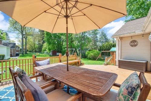
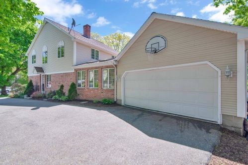
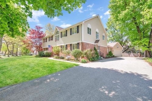
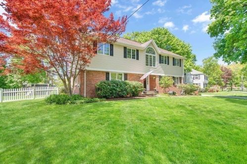
PURCHASE HISTORY 29 Dartmouth Rd, Springfield MA

05/27/198806/28/2012Date$0$25k$50k$75k$100k$125k$150k$175k$200k$225k$250k$275k$300k$325k$350k$375k$400k$425k$450kPrices

Cost estimate history

YearTaxAssessmentMarket
2014 $9,177 $396,400 N/A
Advertisement
Continue Reading Below

Where is 29 Dartmouth Rd, Springfield MA located on map?

Market Activities

To date, we have no information about market activities in 2025
May 2021 Sold
29 Dartmouth Rd
Price history :
  • Single Family
  • 3,443 sqft
  • 5 beds
  • 4 baths
Mar 2018 Sold
29 Dartmouth Rd
Price history :
  • 3,443
  • 5 beds
  • 4 baths

View more

29 Dartmouth Rd incidents registered in FEMA
(Federal Emergency Management Agency)

To date, we have no information about incidents registered in FEMA in 2025
31 Jan 2002 Smoke or odor removal
Property Use —
1 or 2 family dwelling

Dartmouth Rd Incidents registered in FEMA
(Federal Emergency Management Agency)

To date, we have no information about incidents registered in FEMA in 2025
21 Jun 2015 Electrical wiring/equipment problem, other
Property Use —
Residential street, road or residential driveway
16 May 2008 Gas leak (natural gas or LPG)
Property Use —
1 or 2 family dwelling
17 Feb 2004 Carbon monoxide incident
Property Use —
1 or 2 family dwelling
11 Oct 2002 Public service assistance, other
Property Use —
1 or 2 family dwelling

View more

Properties Nearby

Street Address
41 Dartmouth Rd, Springfield, MA 01106-1964
Single Family Residential
  • 3 beds
  • 2 baths
  • Lot: 9,560 sqft
  • Built in 1949
42 Dartmouth Rd, Springfield, MA 01106-1902
Single Family Residential
  • 3 beds
  • 2 baths
  • Lot: 0.42 acres
  • Built in 1938
50 Dartmouth Rd, Springfield, MA 01106-1902
Single Family Residential
  • 4 beds
  • 2 baths
  • Lot: 0.37 acres
  • Built in 1938
56 Dartmouth Rd, Springfield, MA 01106-1902
Single Family Residential
  • 3 beds
  • 2 baths
  • Lot: 0.34 acres
  • Built in 1938
62 Dartmouth Rd, Springfield, MA 01106-1902
Single Family Residential
  • 3 beds
  • 2 baths
  • Lot: 0.3 acres
  • Built in 1932
72 Dartmouth Rd, Springfield, MA 01106-1902
Single Family Residential
  • 4 beds
  • 3 baths
  • Lot: 0.37 acres
  • Built in 1934
90 Dartmouth Rd, Springfield, MA 01106-1902
Single Family Residential
  • 4 beds
  • 2 baths
  • Lot: 1.22 acres
  • Built in 1942
 

FAQ about the house at 29 Dartmouth Rd, Springfield, MA

Advertisement

NOTICE: You may not use Homemetry or the information it provides to make decisions about employment, credit, housing or any other purpose that would require Fair Credit Reporting Act (FCRA) compliance. Homemetry is not a Consumer Reporting Agency (CRA) as defined by the FCRA and does not provide consumer reports.