39 Plymouth St Manchester, NH 03102 / 4171

Residence for Single Family

(UPDATED: 09/11/2025)
  • 4 Beds
  • 2 Baths
  • 1.578 square feet
Sold Apr 2024
$415,000
Property Report

Information about property on 39 Plymouth St, Manchester NH, 03102-4171. Find out owner contacts, building history, price, neighborhood at Homemetry Address Directory.

Property Details

At 39 Plymouth Street, Manchester, New Hampshire based a single-family Cape-cod style possession.

Facts

  • Built in 1940
  • Lot size 4,041 sqft
  • Floor size 1,578 sqft
  • Building 1
  • Rooms 6
  • Bedrooms 4
  • Bathrooms 2
  • Stories 2 story
  • Style Cape Cod
  • Structure type Cape cod
  • Heating & Cooling
  • Heat type Forced air unit
  • Exterior Home Features
  • Exterior material Other
  • Exterior walls Siding (Alum/Vinyl)
  • Roof type Asphalt
Advertisement
Continue Reading Below

Listing info

  • Last sold Jun 2010 for $4,000

Householders and Tenants for 39 Plymouth St, Manchester NH

Purchase History

DateEventPriceSourceAgents
06/29/2010 Sold $180,000 Public records
07/17/2003 Sold $210,900 Public records
09/01/2000 Sold $125,000 Public records

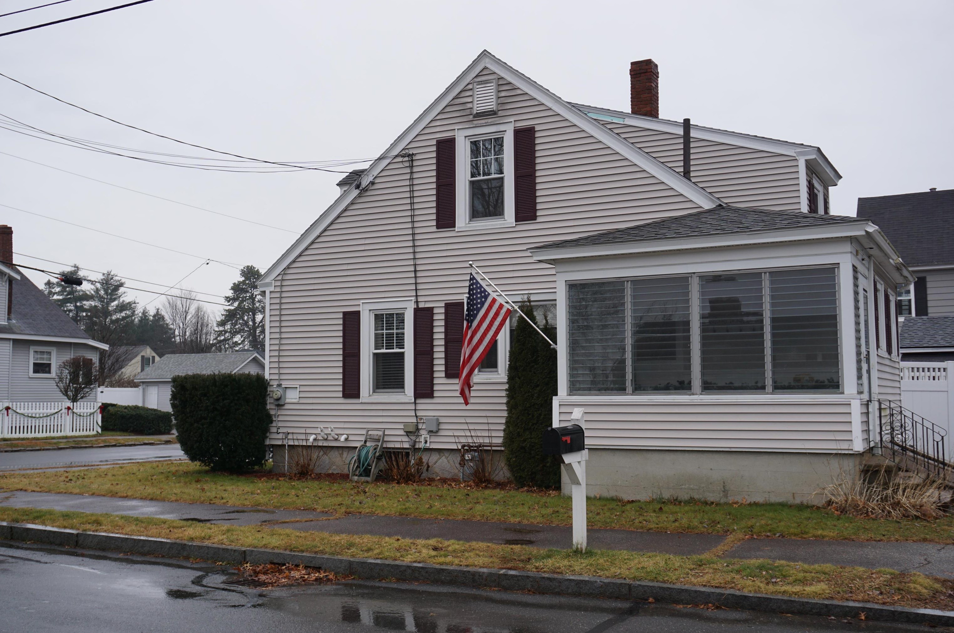
PURCHASE HISTORY 39 Plymouth St, Manchester NH

09/01/200006/29/2010Date$0$20k$40k$60k$80k$100k$120k$140k$160k$180k$200k$220kPrices

Cost estimate history

YearTaxAssessmentMarket
2013 $3,809 $168,000 N/A
Advertisement
Continue Reading Below

Where is 39 Plymouth St, Manchester NH located on map?

Market Activities

To date, we have no information about market activities in 2025
Apr 2024 Sold
39 Plymouth St
Price history :
  • Single Family
  • 1,813 sqft
  • 4 beds
  • 2 baths
Dec 2023 Sold
39 Plymouth St
Price history :
  • Single Family
  • 1,813 sqft
  • 4 beds
  • 2 baths
Oct 2017 Sold
39 Plymouth St
Price history :
  • 1,113
  • 4 beds
  • 2 baths

View more

39 Plymouth St incidents registered in FEMA
(Federal Emergency Management Agency)

To date, we have no information about incidents registered in FEMA in 2025
09 Feb 2005 Electrical wiring/equipment problem, other
Property Use —
1 or 2 family dwelling

Plymouth St Incidents registered in FEMA
(Federal Emergency Management Agency)

To date, we have no information about incidents registered in FEMA in 2025
24 Jun 2008 Oil or other combustible liquid spill
Property Use —
1 or 2 family dwelling
09 Feb 2005 Electrical wiring/equipment problem, other
Property Use —
1 or 2 family dwelling
07 Feb 2001 Emergency medical service, other (conversion only)
Property Use —
1 or 2 family dwelling
05 Feb 2001 Emergency medical service, other (conversion only)
Property Use —
1 or 2 family dwelling

View more

Properties Nearby

Street Address
28 Plymouth St, Manchester, NH 03102-4140
Single Family Residential
  • 3 beds
  • 2 baths
  • Lot: 0.26 acres
  • Built in 2004
43 Plymouth St, Manchester, NH 03102-4171
Single Family Residential
  • 2 beds
  • 1 bath
  • Lot: 0.26 acres
  • Built in 1893
45 Plymouth St, Manchester, NH 03102-4171
Single Family Residential
  • 2 beds
  • 1 bath
  • Lot: 4,198 sqft
  • Built in 1900
56 Plymouth St, Manchester, NH 03102-4169
Single Family Residential
  • 4 beds
  • 1 bath
  • Lot: 0.26 acres
  • Built in 1920
65 Plymouth St, Manchester, NH 03102-4171
Single Family Residential
  • 3 beds
  • 2 baths
  • Lot: 7,500 sqft
  • Built in 1993
68 Plymouth St, Manchester, NH 03102-4170
Single Family Residential
  • 3 beds
  • 1 bath
  • Lot: 7,500 sqft
  • Built in 1900
 

FAQ about the house at 39 Plymouth St, Manchester, NH

Advertisement

NOTICE: You may not use Homemetry or the information it provides to make decisions about employment, credit, housing or any other purpose that would require Fair Credit Reporting Act (FCRA) compliance. Homemetry is not a Consumer Reporting Agency (CRA) as defined by the FCRA and does not provide consumer reports.