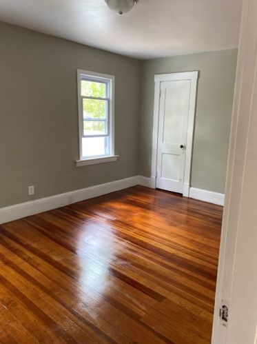
59 Daviston St Springfield, MA 01108 / 2225

Residence for Single Family

(UPDATED: 08/23/2025)
  • 3 Beds
  • 1 Baths
  • 5.001 square feet
Sold Jul 2021
$220,000
Property Report

Information about property on 59 Daviston St, Springfield MA, 01108-2225. Find out owner contacts, building history, price, neighborhood at Homemetry Address Directory.

Property Details

As is shown in our records this property is placed at 59 Daviston Street, Springfield, MA.

Facts

  • Built in 1924
  • Lot size 5,001 sqft
  • Building 1
  • Rooms 6
  • Bedrooms 3
  • Stories 2 story with basement
  • Basement Full Basement
  • Structure type Colonial
  • Heating & Cooling
  • Heat type Steam
  • Exterior Home Features
  • Exterior material Wood
  • Exterior walls Wood Siding
  • Parking & Garage
  • Parking Detached Garage
Advertisement
Continue Reading Below

Listing info

  • Last sold Jun 2008 for $132,500

Features

  • Fireplace

Householders and Tenants for 59 Daviston St, Springfield MA

Purchase History

DateEventPriceSourceAgents
06/24/2008 Sold $132,500 Public records
06/11/2004 Sold $126,900 Public records

Cost estimate history

YearTaxAssessmentMarket
2014 $2,481 $125,900 N/A
Advertisement
Continue Reading Below

Where is 59 Daviston St, Springfield MA located on map?

Market Activities

To date, we have no information about market activities in 2025
Jul 2021 Sold
59 Daviston St
Price history :
  • Single Family
  • 1,412 sqft
  • 3 beds
  • 1 bath
Apr 2021 Sold
59 Daviston St
Price history :
  • Single Family
  • 1,412 sqft
  • 3 beds
  • 1 bath
May 2016 Sold
59 Daviston St
Price history :
  • Single-Family Home
  • 1,412 sqft
  • 3 beds
  • 2 baths

View more

Daviston St Fire Incident History

To date, we have no information about fire incidents in 2025
02 Jul 2010 Passenger vehicle fire
Property Use —
Residential street, road or residential driveway
Area of Origin —
Operator/passenger area of transportation equip.

59 Daviston St incidents registered in FEMA
(Federal Emergency Management Agency)

To date, we have no information about incidents registered in FEMA in 2025
22 Oct 2011 Outside rubbish fire, other
Property Use —
1 or 2 family dwelling

Daviston St Incidents registered in FEMA
(Federal Emergency Management Agency)

To date, we have no information about incidents registered in FEMA in 2025
26 Jul 2013 Unauthorized burning
Property Use —
1 or 2 family dwelling
20 May 2013 Cooking fire, confined to container
Property Use —
1 or 2 family dwelling
15 Dec 2011 Fuel burner/boiler malfunction, fire confined
Property Use —
1 or 2 family dwelling
05 Nov 2011 Power line down
Property Use —
Street, other

View more

Properties Nearby

Street Address
38 Daviston St, Springfield, MA 01108-2226
Single Family
  • 3 beds
  • 1 bath
  • Lot: 5,001 sqft
  • Built in 1920
44 Daviston St, Springfield, MA 01108-2226
Single Family Residential
  • 3 beds
  • 1 bath
  • Lot: 5,053 sqft
  • Built in 1922
58 Daviston St, Springfield, MA 01108-2226
Multiple Occupancy
  • 4 beds
  • 2 baths
  • Lot: 4,051 sqft
  • Built in 1919
63 Daviston St, Springfield, MA 01108-2225
Single Family
  • 3 beds
  • 1 bath
  • Lot: 5,001 sqft
  • Built in 1924
67 Daviston St, Springfield, MA 01108-2225
Single Family
  • 3 beds
  • 1 bath
  • Lot: 5,001 sqft
  • Built in 1922
71 Daviston St, Springfield, MA 01108-2225
Single Family
  • 3 beds
  • 1 bath
  • Lot: 5,001 sqft
  • Built in 1922
77 Daviston St, Springfield, MA 01108-2225
Single Family
  • 3 beds
  • 2 baths
  • Lot: 5,001 sqft
  • Built in 1921
81 Daviston St, Springfield, MA 01108-2225
Single Family
  • 3 beds
  • 1 bath
  • Lot: 5,001 sqft
  • Built in 1921
 

FAQ about the house at 59 Daviston St, Springfield, MA

Advertisement

NOTICE: You may not use Homemetry or the information it provides to make decisions about employment, credit, housing or any other purpose that would require Fair Credit Reporting Act (FCRA) compliance. Homemetry is not a Consumer Reporting Agency (CRA) as defined by the FCRA and does not provide consumer reports.