Cost estimate history
| Year | Tax | Assessment | Market |
|---|---|---|---|
| 2013 | $10,585 | $285,400 | N/A |
Advertisement
Continue Reading Below
Market Activities
To date, we have no information about market activities in 2026
Jun 2023
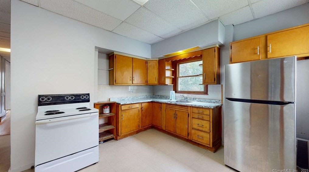
Listed for rent
Jul 2021
Sold
Apr 2021
Sold
Apr 2021
Sold
766 Broad St Fire Incident History
To date, we have no information about fire incidents in 2026
17 Nov 2009
Cooking fire, confined to container
Property Use —
Multifamily dwellings
Area of Origin —
Cooking area, kitchen
First Ignition —
Cooking materials, including edible materials
Heat Source —
Radiated, conducted heat from operating equipment
01 Nov 2004
Cooking fire, confined to container
Property Use —
Multifamily dwellings
Area of Origin —
Cooking area, kitchen
First Ignition —
Box, carton, bag, basket, barrel
Heat Source —
Radiated, conducted heat from operating equipment
14 Nov 2003
Natural vegetation fire, other
Property Use —
Vehicle parking area
Area of Origin —
Highway, parking lot, street: on or near
First Ignition —
Box, carton, bag, basket, barrel
Heat Source —
Radiated, conducted heat from operating equipment
Broad St Fire Incident History
To date, we have no information about fire incidents in 2026
26 Oct 2019
Passenger vehicle fire
Property Use —
Street or road in commercial area
04 Jul 2019
Natural vegetation fire, other
Property Use —
Food and beverage sales, grocery store
Area of Origin —
Highway, parking lot, street: on or near
First Ignition —
Light vegetation - not crop, including grass
08 Jun 2019
Building fires
Property Use —
Motor vehicle or boat sales, services, repair
Area of Origin —
Sales area, showroom (exclude display window)
First Ignition —
Flammable liquid/gas - in/from final container
Heat Source —
Heat from other open flame or smoking materials
01 Jun 2018
Mobile property (vehicle) fire, other
Property Use —
Food and beverage sales, grocery store
Area of Origin —
Highway, parking lot, street: on or near
First Ignition —
Light vegetation - not crop, including grass
766 Broad St incidents registered in FEMA
(Federal Emergency Management Agency)
To date, we have no information about incidents registered in FEMA in 2026
14 Dec 2003
EMS call, excluding vehicle accident with injury
Property Use —
Multifamily dwellings
13 Dec 2003
EMS call, excluding vehicle accident with injury
Property Use —
Multifamily dwellings
11 Nov 2003
EMS call, excluding vehicle accident with injury
Property Use —
Multifamily dwellings
10 Nov 2003
EMS call, excluding vehicle accident with injury
Property Use —
Multifamily dwellings
Broad St Incidents registered in FEMA
(Federal Emergency Management Agency)
To date, we have no information about incidents registered in FEMA in 2026
08 Dec 2015
Vehicle accident, general cleanup
Property Use —
Highway or divided highway
24 Nov 2015
Vehicle accident, general cleanup
Property Use —
Street or road in commercial area
22 Nov 2015
Carbon monoxide incident
Property Use —
Multifamily dwellings
21 Nov 2015
Gas leak (natural gas or LPG)
Property Use —
Residential street, road or residential driveway
Properties Nearby
| Street Address |
|---|
106 Broad St, Meriden, CT 06450-6517 Single Family Residential
|
156 Broad St, Meriden, CT 06450-6524 Multi-Family Home
|
174 Broad St, Meriden, CT 06450-6524 Single Family Residential
|
198 Broad St, Meriden, CT 06450-6524 Multi-Family Home
|
541 Broad St, Meriden, CT 06450-6648 Multi-Family Home
|
621 Broad St, Meriden, CT 06450-4339 Single Family
|
649 Broad St, Meriden, CT 06450-4339 Multi-Family Home
|
51A Broad St, Meriden, CT Lot/Land
|