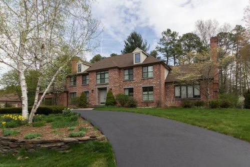
Purchase History
| Date | Event | Price | Source | Agents |
|---|---|---|---|---|
| 05/28/2004 | Sold | $870,000 | Public records |
Cost estimate history
| Year | Tax | Assessment | Market |
|---|---|---|---|
| 2014 | $20,594 | $889,600 | N/A |
Advertisement
Continue Reading Below
Market Activities
Ashford Rd Fire Incident History
To date, we have no information about fire incidents in 2026
01 Nov 2016
Natural vegetation fire, other
Property Use —
1 or 2 family dwelling
Area of Origin —
Outside area, other
First Ignition —
Light vegetation - not crop, including grass
79 Ashford Rd incidents registered in FEMA
(Federal Emergency Management Agency)
To date, we have no information about incidents registered in FEMA in 2026
22 Jan 2003
Smoke detector activation due to malfunction
Property Use —
1 or 2 family dwelling
26 Jul 2002
EMS call, excluding vehicle accident with injury
Property Use —
1 or 2 family dwelling
09 Dec 2001
EMS call, excluding vehicle accident with injury
Property Use —
1 or 2 family dwelling
Ashford Rd Incidents registered in FEMA
(Federal Emergency Management Agency)
To date, we have no information about incidents registered in FEMA in 2026
08 Aug 2012
Outside rubbish, trash or waste fire
Property Use —
1 or 2 family dwelling
19 Jan 2009
Carbon monoxide incident
Property Use —
1 or 2 family dwelling
12 Jan 2009
Carbon monoxide incident
Property Use —
1 or 2 family dwelling
19 Feb 2008
Overheated motor
Property Use —
1 or 2 family dwelling
Properties Nearby
| Street Address |
|---|
20 Ashford Rd, Springfield, MA 01106-2542 Single Family
|
21 Ashford Rd, Springfield, MA 01106-2541 Single Family
|
32 Ashford Rd, Springfield, MA 01106-2542 Single Family Residential
|
33 Ashford Rd, Springfield, MA 01106-2541 Single Family Residential
|