86 Mccarthy Rd, Newton MA  02459-3613 exterior

86 Mccarthy Rd Newton, MA 02459 / 3613

Residence for Single Family

(UPDATED: 08/03/2025)
  • 4 Beds
  • 2 Baths
  • 5.354 square feet
Property Report

Information about property on 86 Mccarthy Rd, Newton MA, 02459-3613. Find out owner contacts, building history, price, neighborhood at Homemetry Address Directory.

Property Details

This is a single-family home, which is situated at 86 Mccarthy Road, Newton, MA.

Facts

  • Built in 2005
  • Property use Single Family
  • Lot size 10,880 sqft
  • Effective area 4,969 sqft
  • Gross building area 5,354 sqft
  • Building type Residential
  • Rooms 9
  • Bedrooms 4
  • Bathrooms 5
  • Stories 2
  • Exterior condition Good
  • Trim None
  • Foundation type Concrete
  • Roof material Asphalt Shingl
  • Fuel type Gas
  • Air conditioning Central
  • Frontage 80 feet
  • Basement area 1,542 sqft
  • Finished basement area 1,157 sqft
  • Deck area 80 sqft
  • Attached garage area 480 sqft
  • Heating & Cooling
  • Heat type Hot Water
  • Exterior Home Features
  • Exterior walls Clapboard
  • Roof type Gable
Advertisement
Continue Reading Below

Householders and Tenants for 86 Mccarthy Rd, Newton MA

86 Mccarthy Rd, Newton MA  02459-3613 plot plan 86 Mccarthy Rd, Newton MA  02459-3613 floor plan 86 Mccarthy Rd, Newton MA  02459-3613 aerial view

Purchase History

DateEventPriceSourceAgents
08/20/2014 Sold $1,368,000 Agent Submission Katherine Meisenheimer
08/31/2007 Sold $1,245,000 Public records
12/24/2002 Sold $400,000 Public records
03/28/2001 Sold $347,328 Public records

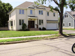
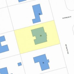
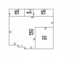
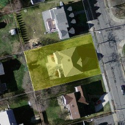
PURCHASE HISTORY 86 Mccarthy Rd, Newton MA

03/28/200108/31/2007Date$0$100k$200k$300k$400k$500k$600k$700k$800k$900k$1.0M$1.1M$1.2M$1.3M$1.4MPrices

Cost estimate history

YearAssessment
2016 $1,352,200
2015 $1,068,300
2014 $1,026,800
2013 $1,026,800
2012 $1,026,800
2011 $1,033,700
2010 $1,054,800
2009 $1,076,300
2008 $1,011,600
2007 $910,400
2006$491,000
2005$491,000
2004$433,300
2003$386,900
2002$386,900
2001$350,200
2000$319,800
1999$291,000
1998$248,300
1997$227,800
1996$227,800
1995$190,500
1994$183,200
1993$185,300
1992$205,600
Advertisement
Continue Reading Below

Where is 86 Mccarthy Rd, Newton MA located on map?

Mccarthy Rd Incidents registered in FEMA
(Federal Emergency Management Agency)

To date, we have no information about incidents registered in FEMA in 2025
16 Jul 2003 Unintentional transmission of alarm, other
Property Use —
1 or 2 family dwelling

Properties Nearby

Street Address
6 Mccarthy Rd, Newton, MA 02459-3505
Single Family
  • 4 beds
  • 2 baths
  • 2,544 sqft
  • Built in 1948
63 Mccarthy Rd, Newton, MA 02459-3507
Single Family
  • 5 beds
  • 2.5 baths
  • 4,834 sqft
  • Built in 1997
69 Mccarthy Rd, Newton, MA 02459-3644
Single Family
  • 3 beds
  • 2.5 baths
  • 1,646 sqft
  • Built in 1949
75 Mccarthy Rd, Newton, MA 02459-3644
Single Family
  • 5 beds
  • 3.5 baths
  • 3,240 sqft
  • Built in 1949
76 Mccarthy Rd, Newton, MA 02459-3613
Single Family
  • 5 beds
  • 4.5 baths
  • 5,058 sqft
  • Built in 1948
 

FAQ about the house at 86 Mccarthy Rd, Newton, MA

Advertisement

NOTICE: You may not use Homemetry or the information it provides to make decisions about employment, credit, housing or any other purpose that would require Fair Credit Reporting Act (FCRA) compliance. Homemetry is not a Consumer Reporting Agency (CRA) as defined by the FCRA and does not provide consumer reports.